More rain coming
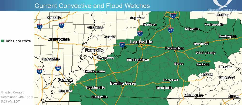
The National Weather Service in Louisville has issued a
* Flash Flood Watch for portions of southern Indiana and central Kentucky
* From 11 PM EDT /10 PM CDT/ this evening through Wednesday afternoon
* A slow-moving frontal boundary will remain close enough to the region until a cold front pushes it through on Wednesday. Plenty of moisture in the vicinity of this front will mean any shower or storm will have the potential to produce heavy rain.
* Storm total rainfall through Wednesday likely will range from 2 to 4 inches for most locations in the watch area. Locally higher amounts are possible, especially in areas that receive several rounds of stronger storms.
* This much rain falling on saturated grounds likely will cause standing water on area roadways as well as quick rises on creeks and small streams.
* There will be dry times within this extended watch period. At this point, the best chance for widespread heavy rain looks to be late tonight and into the Monday morning rush hour, especially along and west of I-65, then again Tuesday afternoon and night as storms associated with the cold front move through.
Instructions:
A Flash Flood Watch means that conditions may develop that lead to flash flooding. Flash flooding is a very dangerous situation. You should monitor later forecasts and be prepared to take action should Flash Flood Warnings be issued.
 Canaan Boy Dies, Parents Injured When Tree Falls on Home During Storm
 COMMUNITY FOUNDATION AWARDS COMMUNITY SUPPORT GRANT TO OHIO THEATRE RENOVATIONS
 MADISON PARKS AND RECREATION, BETHANY LEGACY FOUNDATION, AND JANE’S KIDS CONTINUE PARTNERSHIP TO KEEP CRYSTAL BEACH ACCESSIBLE TO ALL