Localized flooding possible
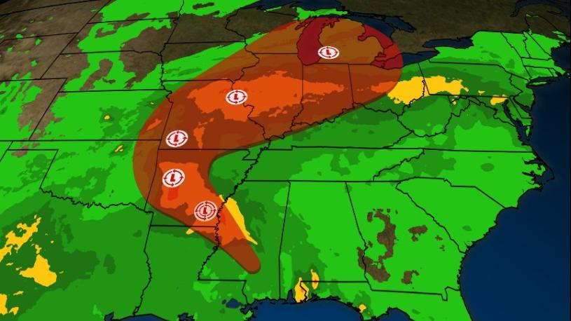
The remnants of Tropical Storm Gordon, currently stalled over Arkansas, will feed moisture slowly up the Ohio Valley through the end of the work week. Rain chances will increase each day, with scattered to numerous heavy rain showers expected on Friday and Saturday. The best coverage currently for both days looks to be along the I-64 corridor.
Saturday night through early Monday, those remnants will get picked up by an upper level disturbance moving into the Midwest. This system will help refocus showers and storms, bringing a large area of heavy rain showers into our region. During this period, areal average rainfall totals of 2 to 3 inches are forecast along and north of the I-64 corridor, with 1-2 inches likely to the south. Locally higher amounts are possible.
Area rivers should be able to handle this influx of rainfall,
though smaller creeks may reach bank full, causing some localized flooding. As the forecast is fine-tuned over the next day or two, a Flood Watch may be required.
 Madison Area Chamber Announces Advantage 1 Health for Small Business Members
 Voices of America County Music Fest Announces Daily Artist Schedule
 Gov. Braun Declares State of Disaster Emergency for 63 Indiana Counties