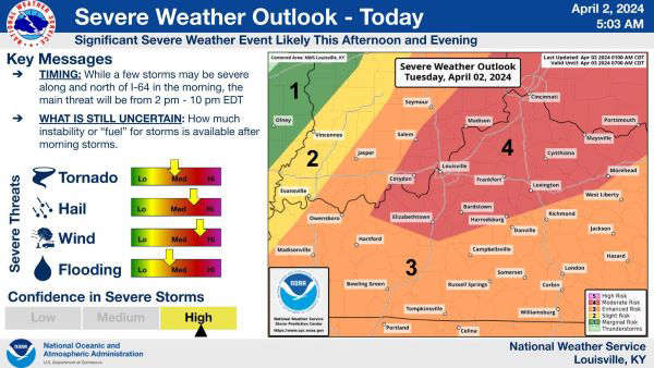
The National Weather Service has a hazardous weather outlook for Indiana, east central Kentucky, and north central Kentucky.
National Weather Service
(Southeast, IN) - The National Weather Service has a hazardous weather outlook for Indiana, east central Kentucky, and north central Kentucky.
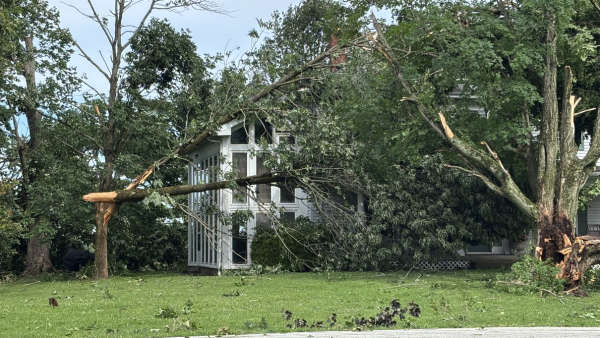
Strong to severe storms are likely Tuesday afternoon with damaging winds, large hail, and tornadoes all being possibilities.
Isolated severe storms are possible for Tuesday morning north of Interstate 64.
The National Weather Service also warns of flooding. Heavy rain causing excessive runoff could cause flooding to creeks, rivers, streams, and other low-lying flood-prone areas.
Rainfall is expected to be two inches with the possibility of higher amounts.
They advise to monitor forecasts and be prepared to take action.
 Madison Area Chamber Announces Advantage 1 Health for Small Business Members
 Voices of America County Music Fest Announces Daily Artist Schedule
 Gov. Braun Declares State of Disaster Emergency for 63 Indiana Counties